Project Description
This project was inspired by the 5th street corridor study conducted by VDOT in collaboration with local planners from the City of Charlottesville, Albemarle County, the Thomas Jefferson Planning District Commission, and the Charlottesville-Albemarle MPO. Current issues in the 5th Street Corridor:
- I-64 serves as a literal barrier on 5th Street and signifies the shift between the denser, more commercial northern half of the corridor and the more residential southern half of the corridor.
- Sidewalks and bike lanes are inconsistent and incomplete along 5th Street, and do not provide the level of safety or comfort necessary to foster walking and biking on the street. Angle crashes are the most common crash type on the corridor and resulted in a higher proportion of fatalities and injuries than other reported crash types.
- Angle crashes are the most common crash type on the corridor and resulted in a higher proportion of fatalities and injuries than other reported crash types.
- 5th Street is the major north-south connection between Charlottesville and Albemarle County south of I-64. The only other connecting street is Old Lynchburg Road. Solutions that consider network level connections are urgently needed.
- The top four transportation problems survey participants observed along the study corridor included traffic congestion, location and quality of sidewalks, speeding, and location of pedestrian crossings
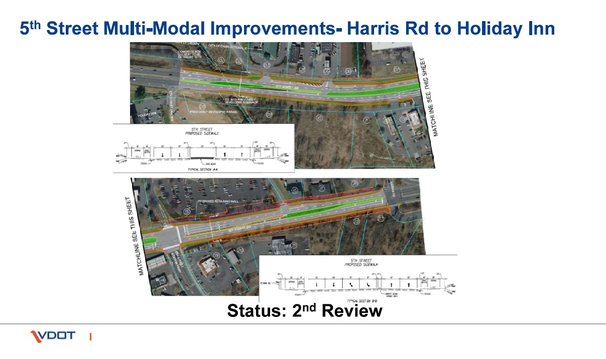
The following changes are the current recommendations to address the problems listed above. The proposed infrastructure updates include adding a left turn lane south into 5th Station from 5th street to address congestion, a left turn lane mid-block going into the Food Lion Shopping Center from 5th Street traveling north and restricting the south turn lane into Food Lion Shopping Center, and adding a loon to address U turn movement at the existing restricted crossover south of the 5th Street Station Parkway Intersection. Additionally, both sides of 5th street will be slightly expanded to add an 8-foot shared use path with a 4-foot buffer strip between the 5th Street Harris Road intersection to the 5th Street landing intersection. Photos displaying this proposed change are shown above.
Needs Addressed

Safety

Congestion

Bicycle Access

Economic Development

Pedestrian Access
Preliminary Cost Estimate (does not include inflation)
2020 estimates from the 5th Street Corridor study estimate that adding 8-foot sidewalks on both sides will cost around $6,100,000- $7,800,000. A restricted U-turn will cost between $2,700,000 to $3,600,000. Other changes currently being considered do not have a cost estimate yet.
Outstanding Concerns
No known concerns at this time
Entity Submitting


